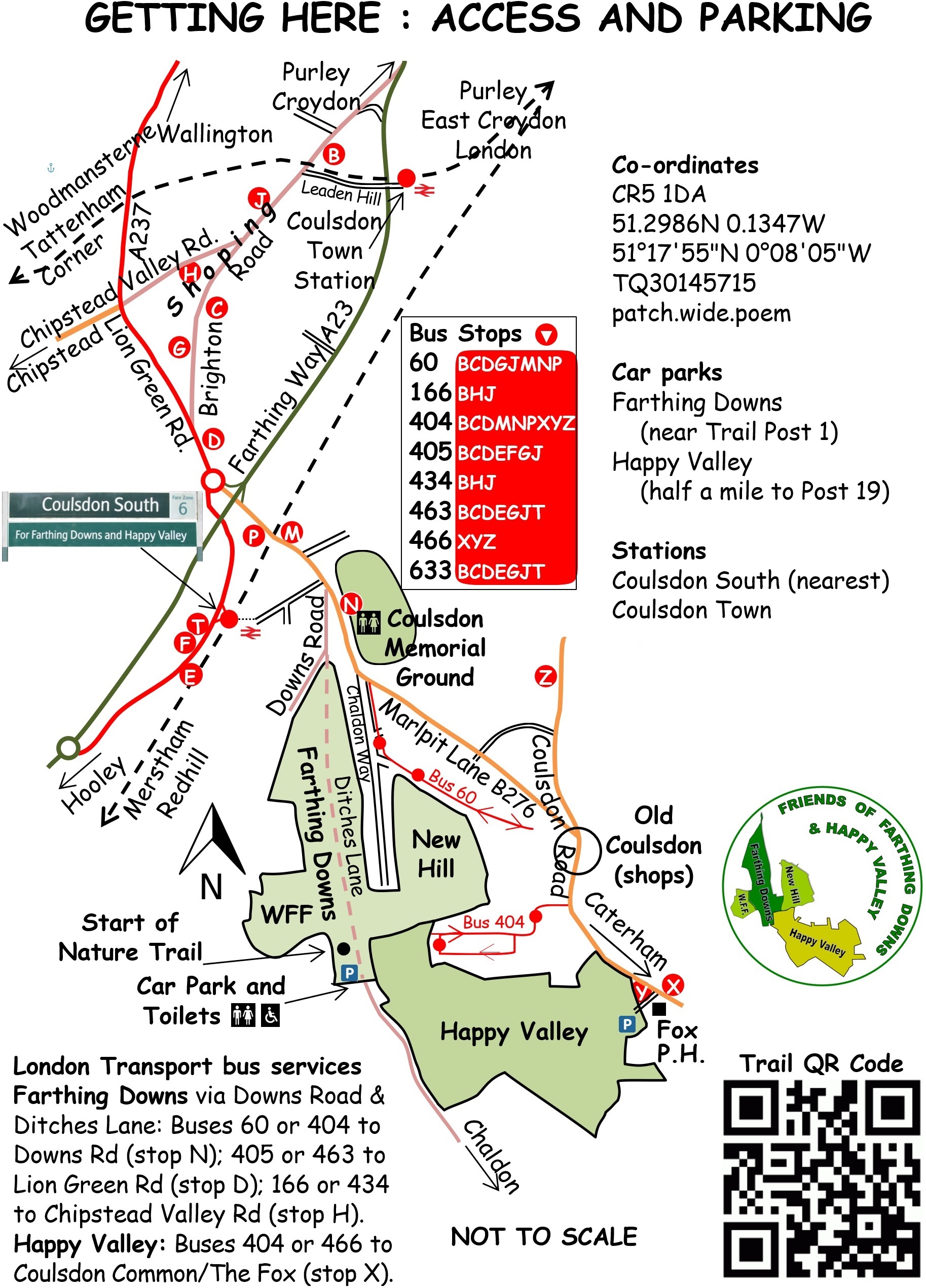
Getting Here (map below)
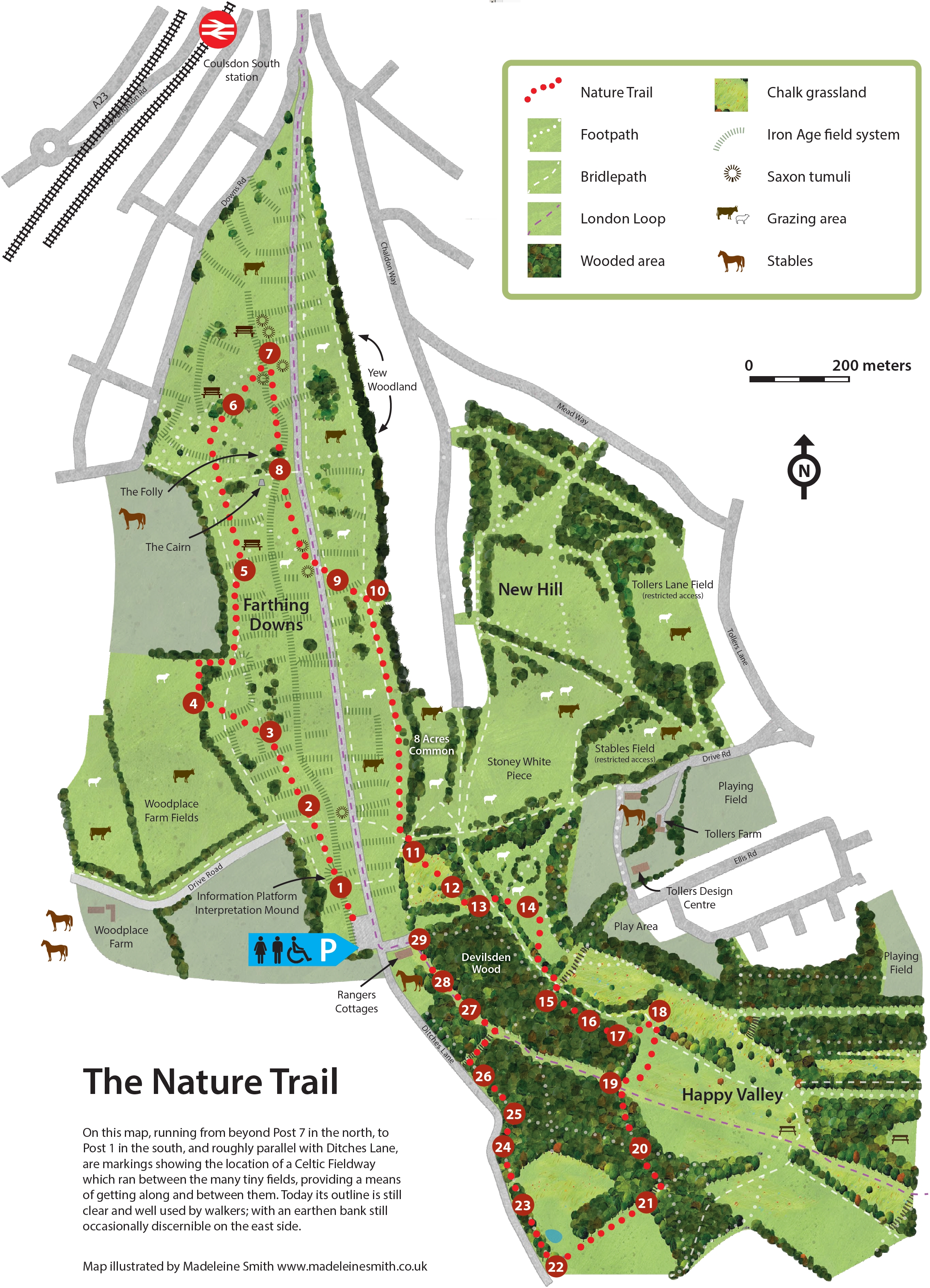
Farthing Downs & Happy Vally Map / Trail Map (click)
Farthing Downs is to the south of Coulsdon Town Centre which has good public transport links. Coulsdon South Railway Station is a stone's throw from the northern entrance to The Downs. The 60 and 404 buses stop just across the road in Marlpit Lane with the 405 and 463 buses stopping outside of Coulsdon South Station. In addition there are 166 and 434 buses which stop in the Town Centre which is less than a mile away.
It is easily accessed by road from south, north east and west and is 2 miles north of the A23/ M25 junction, 2 miles south of Purley and 5 miles south of Croydon Town Centre. It is 3 miles from Wallington and Banstead and about the same from Caterham.
The London Outer Orbital Path (London Loop) runs through Farthing Downs.